The objective of this work package is to characterize the long-term patterns in Critical Zone structure, biogeochemical composition and soil residence time. These patterns will be related to topography and subsurface hydrology.
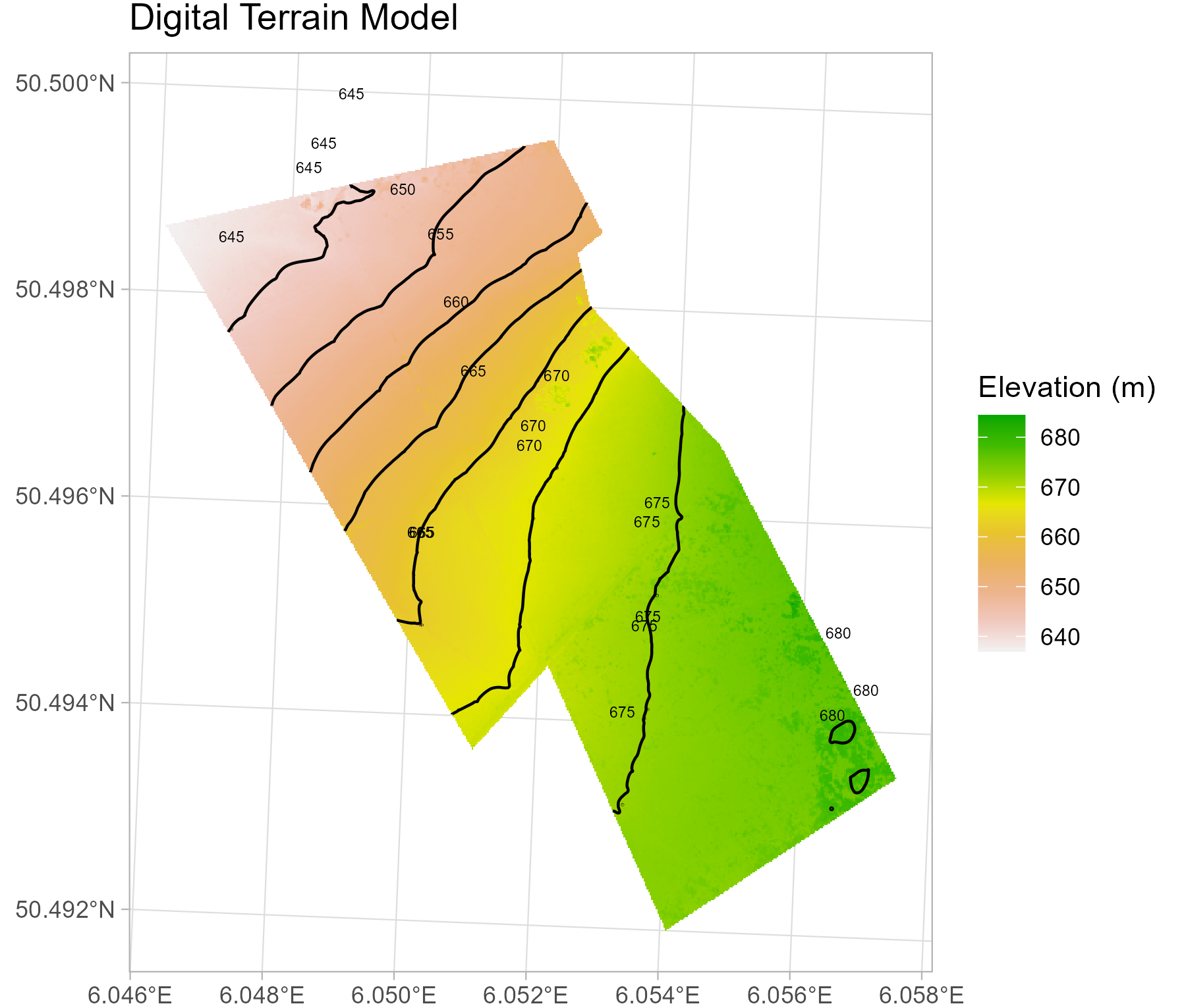
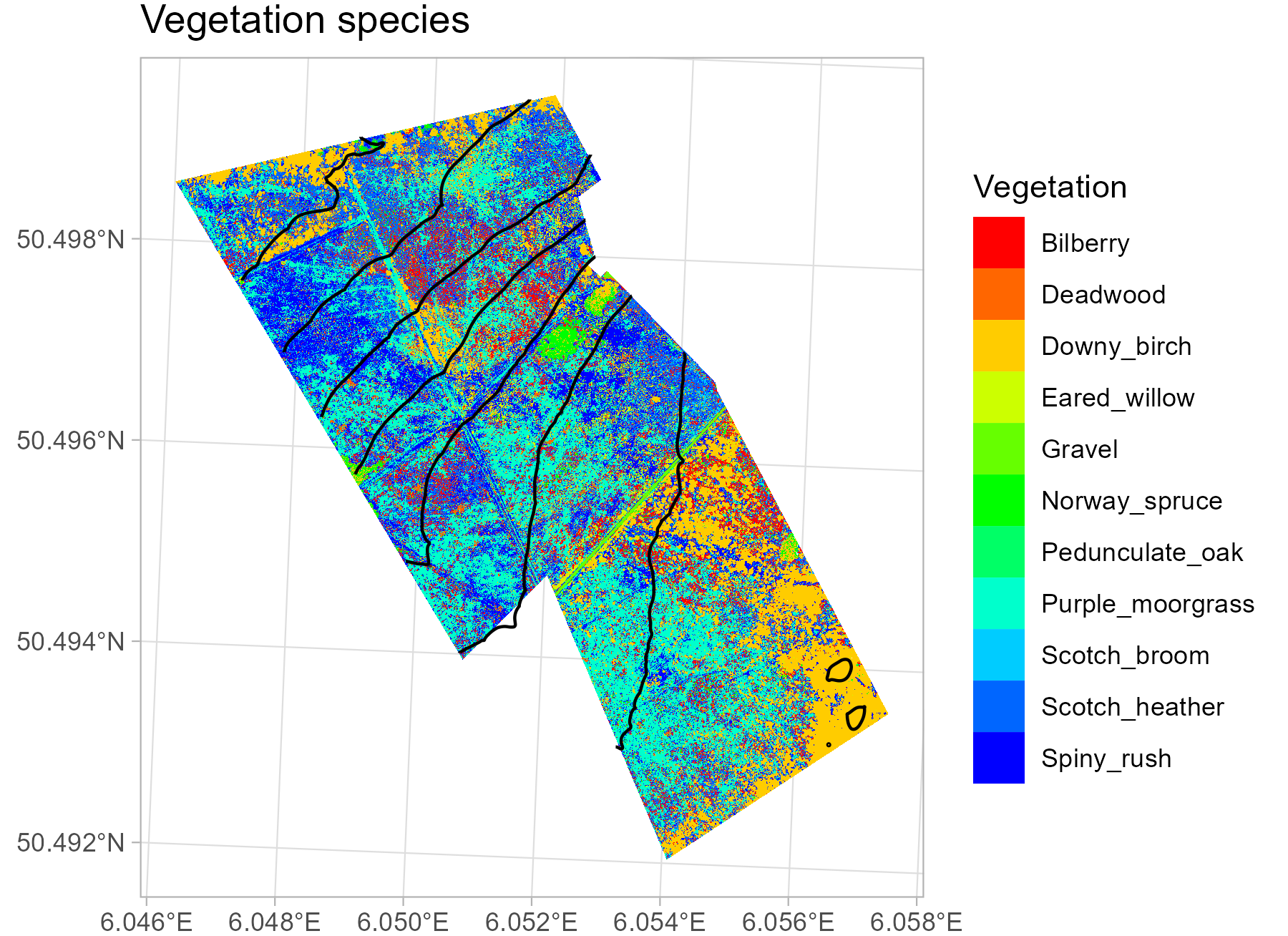
UAV-Lidar and multispectral imagery will allow us to reconstruct (micro-)topography and vegetation type and structure. The DJI L1 lidar, DJI P1 RGB camera, MicaSense multispectral camera, and TeAX thermal infrared camera, which mounted on the DJI M300 RTK drone, allowed us to obatin very high spatio-temporal resolution data. Digital Terrain Model (DTM) was then generated by the the lidar point cloud. A vegetation species map was generated by a Random Forest model using multisensor data.
Focus is made on the characterization of the soil depth, structure and texture in the vadose zone using EMI and GPR techniques.
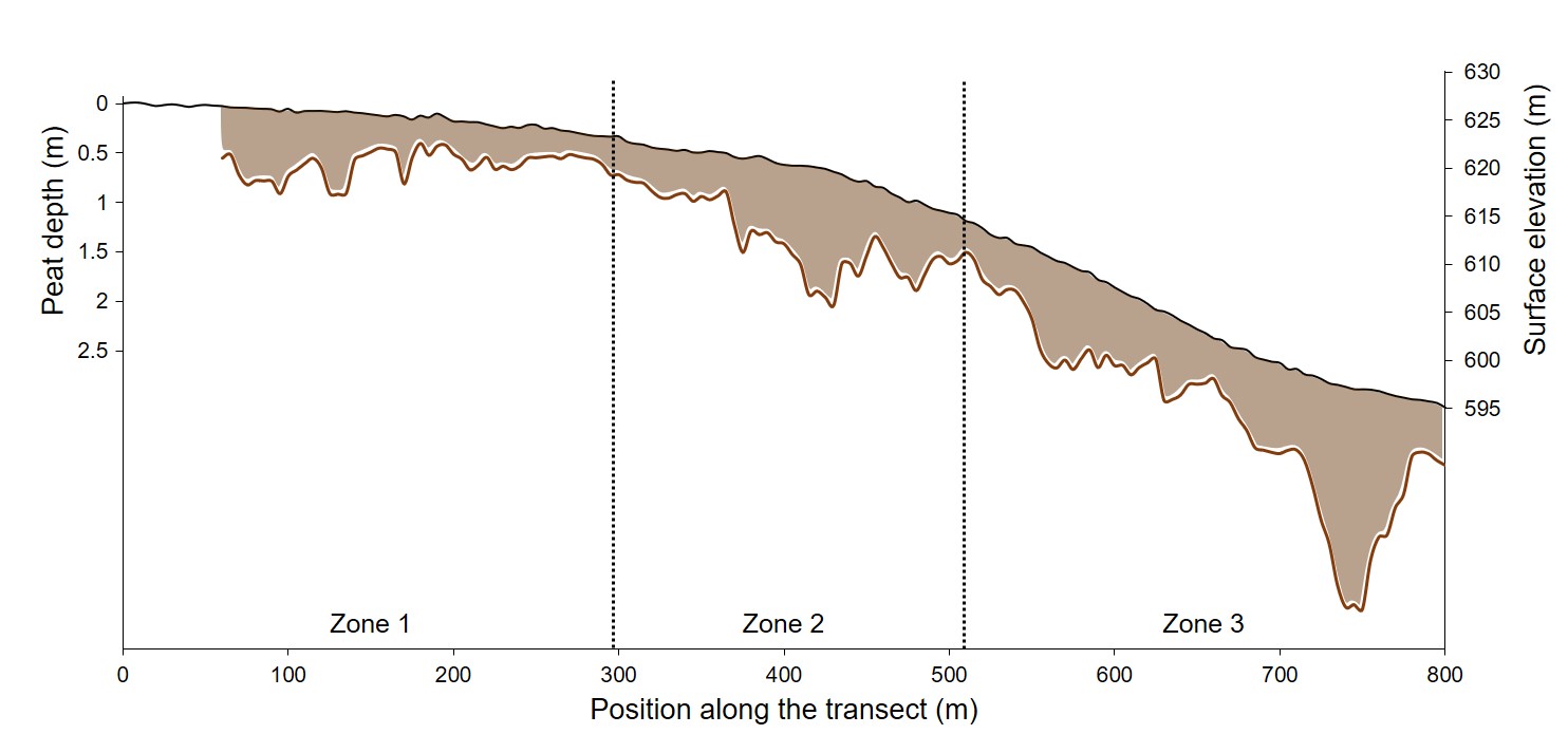
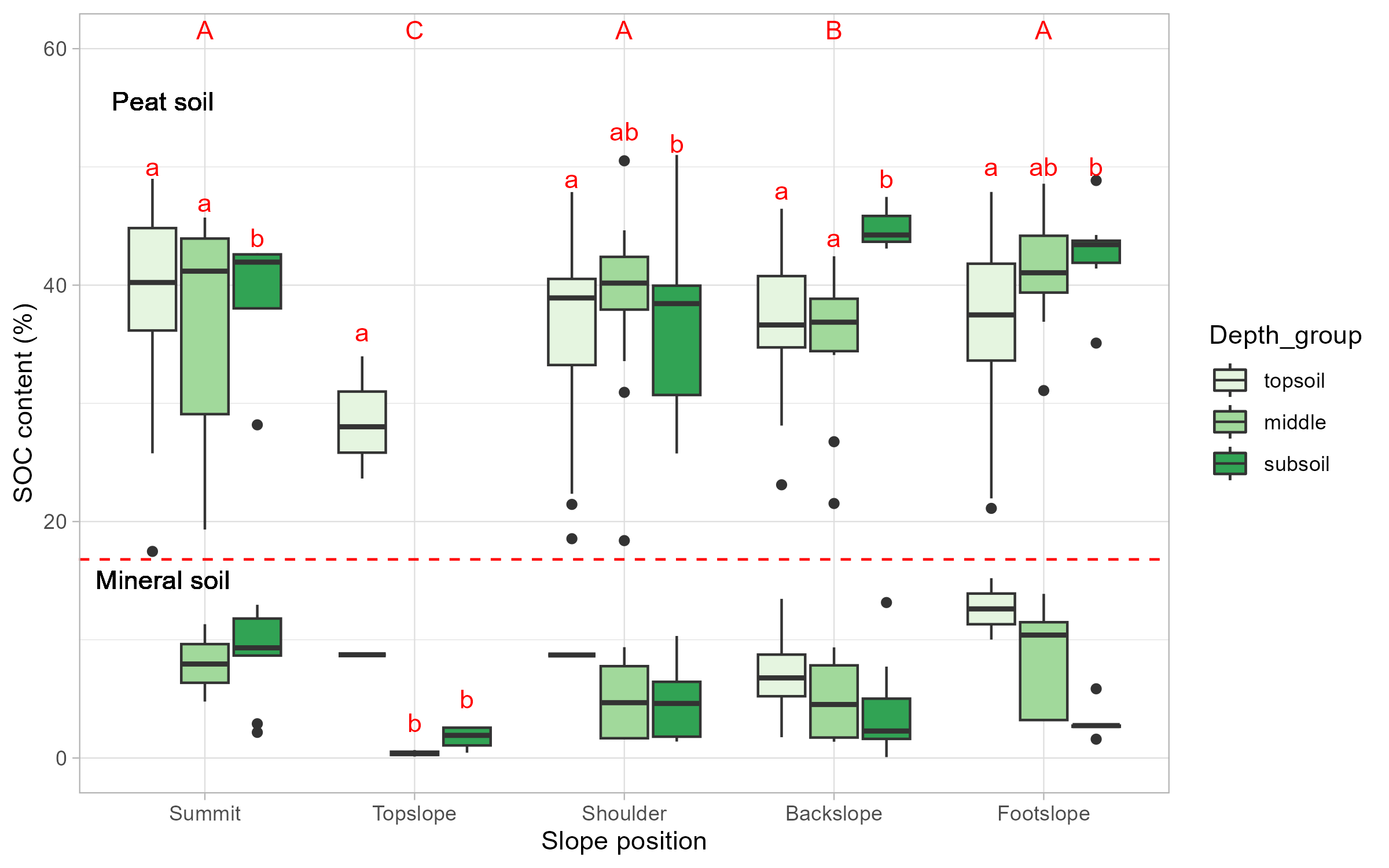
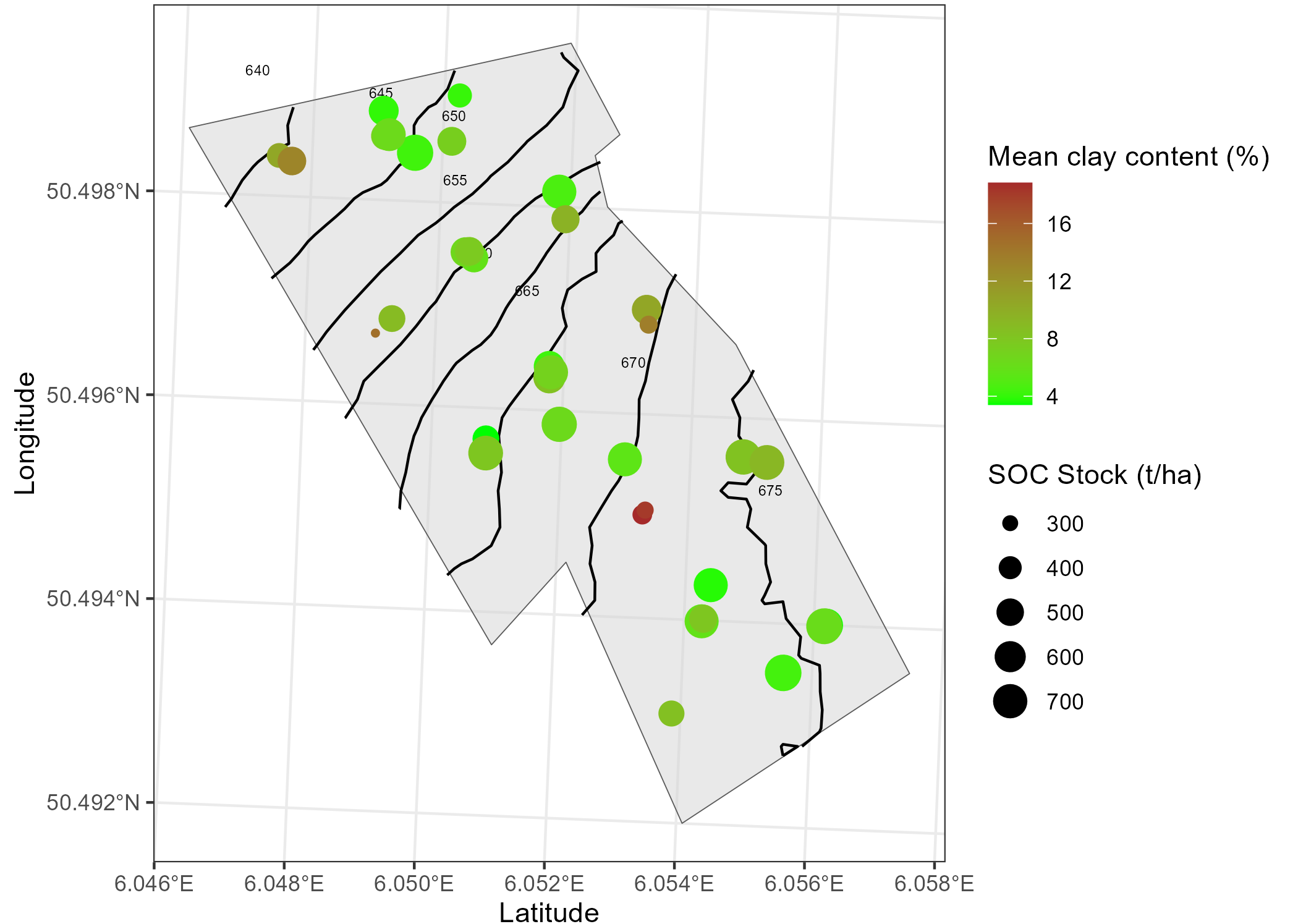
Soil cores were taken at 36 locations along three evenly spaced transects in the field, ensuring that samples were randomly collected under the cover of different vegetation types, and at different slope positions from the summit to the top slope, the shoulder, the backslope, and the footslope. Additionally, samples were collected at depths from 0 cm to 50-150 cm in each vertical soil profile. Soil properties such as SOC content, N content, and soil texture were analyzed in the lab.
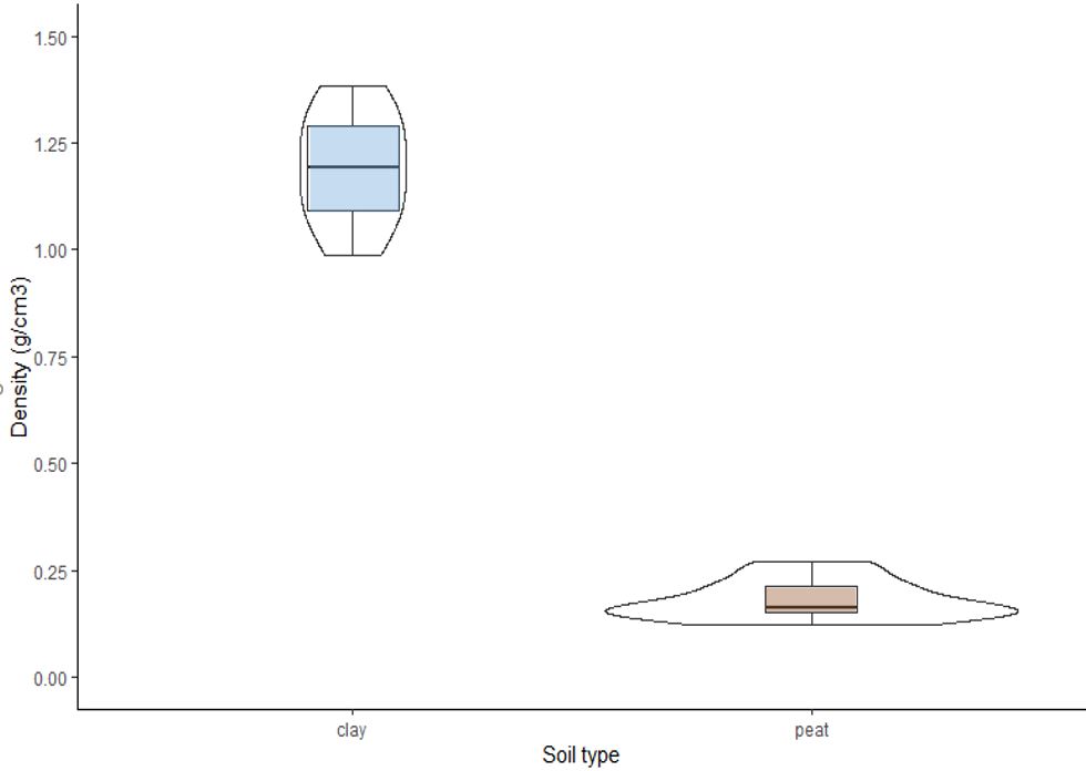
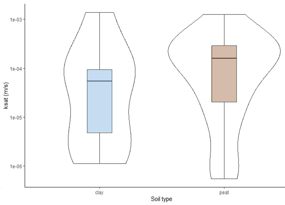
The laboratory determination of the soil hydrodynamic properties (bulk density, saturated hydraulic conductivity and retention curves) was realized for 3 depths at 5 points of interest along the transect. These lab-determined properties will be compared with those retrieved by inverse modeling.
Saprolite samples were collected from 5 positions along the study hillslope. Currently, quartz is being separated from these samples and prepared for measurement of cosmogenic beryllium-10 by accelerator mass spectrometry. Beryllium-10 concentrations will be used to calibrate a hillslope diffusion model and infer spatial variation in downslope velocity and soil residence time.