Involved researchers: Nathan Vandermaelen, Veerle Vanacker, François Clapuyt, Koen Beerten (SCK-CEN)
Summary of the research
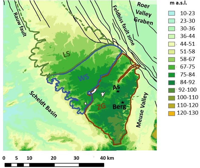
The Campine plateau is a low-lying plateau (NE Belgium) covered by fluvial sediments that were deposited by the braided channels of the Meuse and the Rhine, during the Middle Pleistocene. It resisted the overall erosion that affected the Campine area, and nowadays remarkably stands out of its environment (Fig. 1). This elevated position results from a combination of tectonic subsidence of the neighboring Roer valley graben (NE border), headward erosion from the Scheldt basin (W border), and deep rever incision./terrace formation by the Meuse (E border). This singular case makes the Campine plateau an ideal topographic marker to study the geomorphic processes that determined the current landscape of the European Lowlands.
Cosmogenic radionuclides accumulate at the Earth’ surface as a function of time and depth. They can be used to constrain the age and the deposition mode of fluvial deposits.
In this study, we applied cosmogenic radionuclides on the Zutendaal gravels (eastern Campine plateau) to constrain their depositional and post-depositional history. Main results show that the deposition of the Zutendaal gravels occurred in different phases (Fig. 2), interrupted by long hiatuses that correspond to climatic fluctuations.
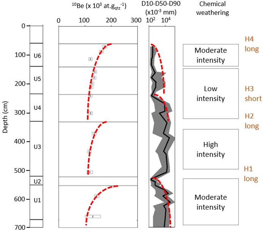
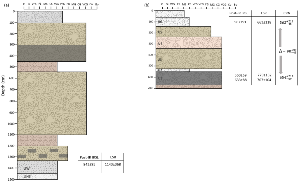
Based on a model simulating the accumulation of CRN over different aggradation phases – and intercalated hiatuses -, the deposition of the Zutendaal gravels would have lasted at least 2 glacial cycles. The code of the model can be found following at : https://doi.org/10.14428/DVN/GGRVT0. This was validated by Luminescence (Post-IR IRSL) and Electron spin resonance dating techniques (Fig. 3). The onset post-depositional time likely started somewhere between the last 500 to 700 ka, and was probably characterized by intermittent burial of the fluvial deposits by aeolian coversands. The post-depositional erosion of the Zutendaal gravels has remained limited to a few meters.
The first numerical ages of the eastern Campine plateau could be used in the future to better constrain the geomorphological evolution of the Campine region and the European Lowlands in general.
References:
Vandermaelen, N., Vanacker, V., Clapuyt, F., Christl, M., and Beerten, K.: Reconstructing the depositional history of Pleistocene fluvial deposits based on grain size, elemental geochemistry and in situ 10Be data, Geomorphology 402, 108127, https://doi.org/10.1016/j.geomorph.2022.108127, 2022.
Vandermaelen, N., Beerten, K., Clapuyt, F., Christl, M., and Vanacker, V.: Constraining the aggradation mode of Pleistocene river deposits based on cosmogenic radionuclide depth profiling and numerical modelling, Geochronology, 4, 713–730, https://doi.org/10.5194/gchron-4-713-2022, 2022.